GIS
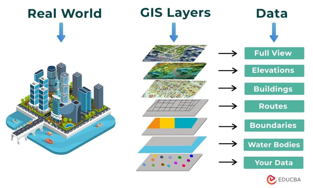
A Geographic Information System (GIS) is a framework of software, hardware, and data used to capture, store, manage, analyze, and visualize spatially referenced information — that is, data tied to specific locations on Earth. Rather than just producing static maps, GIS organizes information into distinct layers (such as roads, land use, elevation, or population density), each representing a different data type, which can be viewed individually or overlaid together to reveal spatial relationships and patterns that wouldn’t be apparent otherwise. This data is drawn from diverse sources, including satellite and aerial imagery, GPS surveys, census records, and digitized historical maps, and is typically stored in one of two core formats: vector data (points, lines, and polygons representing discrete features like buildings or roads) or raster data (grid-based pixel data representing continuous phenomena like elevation or temperature). Because it enables spatial analysis — such as measuring distances, identifying overlaps, or modeling proximity — GIS has become essential across fields like urban planning, environmental science, logistics, and public health, anywhere decisions depend on understanding where something is happening as much as what is happening.
GIS Applications
This video is related the application of GIS in World Pandemic situation.
Uniting Our World
Creating the World You Want to See
Organizations
- Urban and Regional Information Systems Association (URISA)
- GIS Certification Institute (GISCI)
- Environmental Systems Research Institute (ESRI)
- Open Geospatial Consortium (OGC)
- National States Geographic Information Council (NSGIC)
- Quantum Geographic Information System (QGIS)
- OpenStreetMap Foundation
- American Association of Geographers (AAG)